|
|||||
|
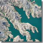
Topography & Aerial Photography At Proinvel we have access to specialised teams in topography and aerial photography plus high quality software to process and produce topographical surveys, measure land/plots and digital images of land. We utilise the latest GPS equipment and use high quality photographical equipment such as LEICA and TOPCON.
Activities:
Reports:
|
||||
 |
|||||
| architecture & urbanism | |||||
| topography & aerial photography |
|||||
| agricultural & industrial engineering |
|||||
| ©Copyright 2012 Proinvel Ingenieros |
| Site by ADIVAS FOTOS |